

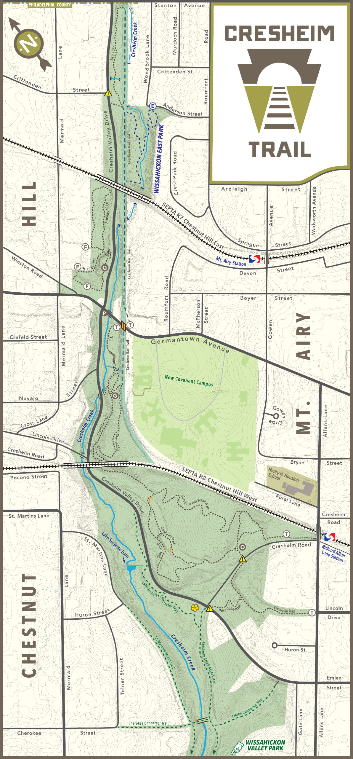
 “Cresheim Trail” is only the starting point. The namesake trail is the backbone of a network built by Friends of the Cresheim Trail volunteers beginning in 2012, extending the Wissahickon outward through Mt. Airy and Chestnut Hill on the way to Fort Washington State Park.
In that timeframe, we’ve built over three miles of single track, native surface trail for hikers, bikers, and runners. We’ve also opened a “rough draft” of the Cresheim Rail Trail, a future segment of the Circuit Trails across the Philadelphia region, between Germantown and Stenton Avenues (and even a small section south of Germantown).
Click on the names below to view a map, elevation profile, description, and photos of each trail in the Cresheim network.